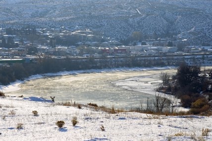
The Thompson River in Kamloops warms up in the sun, but the lack of cloud cover combined with dry air is what is keeping us so cold in the Interior right now.
(JENNIFER STAHN / iNFOnews.ca)
November 21, 2013 - 10:24 AM
THOMPSON-OKANAGAN – This week is cold in the Interior, but it's not that cold according to Doug Lundquist of Environment Canada.
By not that cold he means we aren't hitting record lows, but that's little consolation to those of us waking up to frigid temperatures where we are having to bundle up in toques and mitts and can see our breath, or are having problems starting a car not used to the low temperatures.
Before we go any further let's note the normal range of temperatures for this time of year, for the entire region, is between 3 and -3 Celsius.
Wednesday Kamloops reached a high of -8 C but by 4 p.m. it had already dropped below the -10 C forecast for an overnight low. It was cold enough to make Kamloops one of the coldest places in the southern part of the province according to Lundquist.
“Kamloops was the epicentre of cold, it was the coldest yesterday,” he says of the Southern Interior, “Kamloops has been among the coldest in the southern half of the province the last couple days.”
He says the first shock of cold across the region was because a storm moved over the region and the air it brought was a lot drier and it was less windy than expected, which allowed temperatures to plummet. The second night of cold weather being colder than forecast? That was a mistake.
“It surprised me we got that cold that fast,” Lundquist notes. “The first night we didn't expect.... The second night was a mistake. Not sure if it was human error or something went wrong.”
The positive is some ice wine got off the fields in Penticton, he notes, and the forecast of seven days of sun is likely wrong.
“It's unusual to have five days of sun in the region at this time of year,” Lundquist says, adding more cloud cover could mean warmer temperatures as well. “The clouds, that's our blanket. We may be under-forecast for the weekend.”
The region should 'pop up above zero next week' but until then we can still expect below-normal temperatures. Here's a breakdown of yesterday's temperatures and what we can expect today throughout the region.
Kamloops: Low of -17 C on Wednesday. Record low for Nov. 20 is -18.3 C set in 1996. Record low for Nov. 21 is -17.7 C set in 1985. Woke up to a temperature of -14 C with a high of -5 C expected today.
Vernon: Low of -10.8 C on Wednesday. Record low for Nov. 20 is -17.2 set in 1921. Record low for Nov. 21 is -12 C set in 2003. Woke up to a temperature of -11 C with a high of -4 C expected today.
Kelowna: Low of -11.8 C on Wednesday. Record low for Nov. 20 is -19.4 C set in 1900. Record low for Nov. 21 is -22.8 C also set in 1900. Woke up to a temperature of -10 C with a high of -3 C expected today.
Penticton: Low of -9.5 C on Wednesday. Record low for Nov. 20 is -13.4 C set in 1977. Record low for Nov. 21 is -17.6 set in 1985. Woke up to a temperature of -10 C with a high of -1 C expected today.
To contact a reporter for this story, email jstahn@infotelnews.ca, call (250)819-3723 or tweet @JennStahn.
News from © iNFOnews, 2013