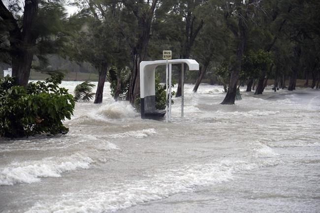
Gale force winds hit the coast of the Indian Ocean Island of Mauritius Monday Feb. 20, 2023. Forecasts say Tropical Cyclone Freddy is increasing in intensity and is expected to pass north of the Indian Ocean island nation of Mauritius and make landfall in central Madagascar Tuesday evening.It's feared that up to 2.2 million people, mostly in Madagascar, will be impacted by storm surges and flooding, according to the Global Disaster Alert and Coordination System. (AP Photo/L'express Maurice)
Republished February 21, 2023 - 11:43 PM
Original Publication Date February 20, 2023 - 5:46 AM
MOMBASA, Kenya (AP) — A cyclone which is intensifying as it approaches the southeastern African coast has been labeled as “dangerous” by the United Nation's weather agency on Monday as nations brace for landfall.
Cyclone Freddy is projected to reach Madagascar on Tuesday evening and hurtle toward Mozambique by the end of the week. The tropical cyclone is equivalent to a Category 4 hurricane and is expected to dump heavy rain and bring turbulent winds.
A “significant deterioration in weather conditions” is underway, Meteo France’s multi-hazard early warning system predicted Monday. The weather agency said the cyclone is passing around 100 kilometers (60 miles) away from the islands of Mauritius and later Reunion on Monday. Mauritius has already encountered flooding and gale force winds.
The regional weather observation center on the island of Reunion said that Freddy is currently rushing across the ocean with average wind speeds of 205 kilometers (127 miles) per hour.
It's feared that up to 2.2 million people, mostly in Madagascar, will be impacted by storm surges and flooding, according to the Global Disaster Alert and Coordination System. The Mahanoro, Mananjary and Nosy Varita communes in western Madagascar will be first-hit on Tuesday.
Mozambique will likely be struck on Friday, according to the country's national meteorology institute. The nation has already experienced widespread flooding in recent weeks, raising fears from the U.N. humanitarian agency that the “severe humanitarian situation in the region” may escalate.
Some five other nations — Botswana, Zambia, Zimbabwe, Eswatini and South Africa — are also vulnerable as Freddy looks set to tear across the Mozambican channel after Wednesday, according to the region's climate service center.
Last year, scientists were able to show that climate change worsened cyclones in southeast Africa, already a hotspot for tropical storms and cyclones.
In the last 12 months the region has suffered a significant battering from a number of cyclones and suffered major loss of life, property, displacement of large populations and costly damages to major infrastructure.
“It is hoped that accurate warnings and forecasts will help limit the damage from Tropical Cyclone Freddy,” said U.N. weather agency spokesperson Clare Nullis.
First spotted and named by a monitoring center in Melbourne, Australia, on Feb. 6, Cyclone Freddy has since crossed the entire southern Indian Ocean.
___
This story has been updated to correct that Botswana, Zambia, Zimbabwe, Eswatini are not directly on the coast.
___
Associated Press climate and environmental coverage receives support from several private foundations. See more about AP’s climate initiative here. The AP is solely responsible for all content.
News from © The Associated Press, 2023