
Kelowna council may to be willing to let a handful of old-timers keep their private beach
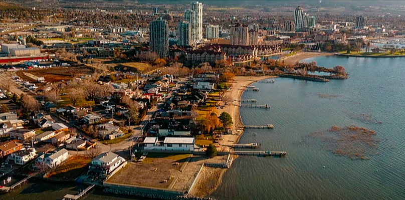
One of the key things most Kelowna residents want to see as the North End redevelops is a lakefront pathway all the way from Knox Mountain to the Bennett bridge.
But 21 property owners along Manhattan Point don’t want that pathway anywhere near their private sandy beach.
And Kelowna city councillors seem inclined to let them have their way.
“I have gone down and walked there,” councillor Mohini Singh told iNFOnews.ca. “There are some families that have lived there forever and enjoyed the beach and they believe they are responsible for the start of the city, the building of the city and so on. If you’ve lived in a certain area for forever and a day, you feel a passion for that.”
Following the closure of the Tolko Mill just north of Manhattan Point in 2019, a planning process was launched for all of the North End from the rapidly redeveloping Clement Avenue area to Knox Mountain.
READ MORE: Changing times: Tolko closure marks the end of a way of life, says local historian
It was obvious from the start the Tolko Lands waterfront would become park.
The city decided to plan for the future of the whole North End at the same time, and heard loud and clear the vast majority of residents wanted the whole waterfront opened up.
The city already owns the tip of Manhattan Point and has a couple of other strips of parkland between there and the Tolko site.
There are 21 privately owned properties between the point and Rotary Marsh next to Tugboat Beach.
Since there is no public access there few people know it’s a sandy beach that below the high water mark is legally open to the public.
Coun. Singh understands that only too well.
“Fortunately for them, they have been able to enjoy private beach access for forever and a day, but can we give them a level of privacy as well as public access there?” Singh said.
“It has to be studied a little bit more. While we want to open things up to the general public we also have to be mindful of individual neighbourhoods and the impact on people’s lives.”
On Monday, March 11, city staff presented council with a proposal to designate 10 of the properties along the beach as future park, pointing out that the city would buy them only when they are put on the market and will pay fair market value based on their highest and best use had they not been designated as future parkland.
The remaining properties would be untouched until the owners rebuild on them. At that point they will have to apply for a natural environment development permit.
In order to get that permit under new rules coming out in a couple of months, 20 metres of their waterfront land will have to be dedicated to the city for a pathway and to protect the riparian area above the high water mark, Corey Davis, a development engineering technologist with the City of Kelowna, told iNFOnews.ca in an email.
READ MORE: Kelowna looking to acquire 10 properties for waterfront parks
Staff wanted council to accept their report so they could send letters to affected residents, telling them this was the city’s “preferred” option, then meet with them before the final North End plan is taken back to council later this year.
That sparked a strong pushback, led by councillor Maxine DeHart.
“People will think, as soon as you turn out that letter, that council has endorsed this,” she protested. "'Preferred’ – that already says we have kind of endorsed it because this is the one we like and I’m sorry, I don’t like that one.”
Coun. DeHart, with the unanimous support of the rest of council, got staff to rewrite the motion to say staff will write the affected residents “regarding the concept for parks in the North End Plan.”
“I think council is going to get a lot of comments and I’m very concerned about that,” she said. “We’ve been through this before. Not quite like this, but I don’t want to go down that road again.”
Residents along Watt Road near Gyro beach launched a court challenge in 2022 after the city designated their properties as a future park.
While Coun. DeHart led the charge in city council chambers, she said she did not have time to talk when contacted by iNFOnews.ca to discuss this issue further.
“I want staff to engage with residents there to see how we can build an open pathway for people to use as well as protect the people who live there,” Coun. Singh said.
She had no suggestions on how that can actually be done and no idea yet how she will vote when this does come back to council.
To contact a reporter for this story, email Rob Munro or call 250-808-0143 or email the editor. You can also submit photos, videos or news tips to the newsroom and be entered to win a monthly prize draw.
We welcome your comments and opinions on our stories but play nice. We won't censor or delete comments unless they contain off-topic statements or links, unnecessary vulgarity, false facts, spam or obviously fake profiles. If you have any concerns about what you see in comments, email the editor in the link above. SUBSCRIBE to our awesome newsletter here.