Okanagan growers and gardeners nervous about coming cold snap
This is not the way it’s supposed to be.
The region had its driest year on record and close to the warmest on record. The year ended on a warm note and continued that way right into the depth of winter.
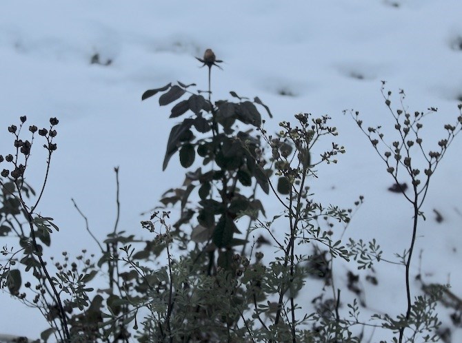
Suddenly, there’s 10 centimetres of snow on the ground in the valley bottoms and temperatures are heading to below -20 Celsius later this week.
“Mother nature is always throwing growers a curve ball,” Laurel Van Dam with the BC Tree Fruits Cooperative told iNFOnews.ca. “There never seems to be a normal of anything anymore.”
READ MORE: 2023 driest year on record in Kamloops, Okanagan
In a normal year temperatures would drop steadily through the fall, the fruit trees would go into dormancy and be protected from such cold temperatures. After all, a few days of -20 C are not at all unusual during an Okanagan winter.
“Because of the warmer temperatures this year so far, there's uncertainty how those fruit buds are going to react,” Van Dam said of the coming cold spell. “Bottom line: 'Is there a little bit of concern? Yes.' But there’s really so many variables that go into it we’ll have to take a look at all the trees on the other side of it.”
Apple and pear trees should be fine but soft fruits are more at risk since they bud much earlier.
According to a post on the Paynter’s Fruit Market Facebook page, peach buds were already starting to form last summer.
The fact that it snowed and is only gradually getting colder does help.
“It’s major swings that really freaks trees out,” Van Dam said. “So, if we’ve got plus 6 C one day then we’ve got -21 C the next day, that’s when trees really go into shock. But we’ve actually got a series of colder days leading into when it’s supposed to do that crazy drop.”
The forecast for Kelowna is for the temperature to fall to -4 C overnight tonight, -8 C tomorrow night then all the way down to -20 C by Thursday morning.
While the impact on fruit trees is critical for growers, there are many home gardeners who may see major damage to their perennials as well.
“We used to tell people to pile leaves and soil around their roses, around the bases of them, but we kind of got away from that in the last several years,” retired GardenWorks horticulturalist and Penticton radio show host Scott Austin told iNFOnews.ca. “It would have seemed silly to have done that last week, or leading up to this. But now, you’ll think that may have been a good idea after all.”
The snow is especially helpful for perennials whose roots tend to be shallower than trees.
It’s not too late to take some preventative action before temperatures plummet Wednesday night.
“If you’ve still got your Christmas tree around, take some branches from that and place them over top of perennials and things that are exposed,” Austin suggested. “That might help trap some snow and keep some air in there. Anything you can do.”
Last winter’s cold snap came early in November and did some serious damage to rose branches and the coming cold may do the same.
But don’t despair, Austin said.
“Some of the branches will definitely be damaged but at least the roots will be OK,” he said. “I think a lot of people realized last spring that things that looked dead in April and well into May, they came quite close to the ground. In a lot of cases, as long as the roots aren’t damaged, they will come back.
“I had roses that I cut almost right down to the ground because there was no life in them but they came back. By July, they were in full bloom and you never would have known they had such damage. Plants are pretty resilient.”
Anything that showed damage last spring is likely to be impacted this week.
The good news, along with some snow cover, is this cold snap is expected to be short and sharp.
“We start to see the emergence from the cold, not that we get out of it completely, but by Sunday,” Environment Canada meteorologist Armel Castellan told iNFOnews.ca. “We will start to see that pattern shift. There will be a slow resurgence from the supper cold. Monday, Tuesday, Wednesday, you’ll start to see that steady rise.”
Or, as Van Dam phrased it: “This is a cold dip, not an extended snap. So that’s also good news.”
A return to seasonal temperatures later next week still means daytime highs for Kelowna in the -2 C range with overnight lows down to -8 C.
To contact a reporter for this story, email Rob Munro or call 250-808-0143 or email the editor. You can also submit photos, videos or news tips to the newsroom and be entered to win a monthly prize draw.
We welcome your comments and opinions on our stories but play nice. We won't censor or delete comments unless they contain off-topic statements or links, unnecessary vulgarity, false facts, spam or obviously fake profiles. If you have any concerns about what you see in comments, email the editor in the link above. SUBSCRIBE to our awesome newsletter here.