
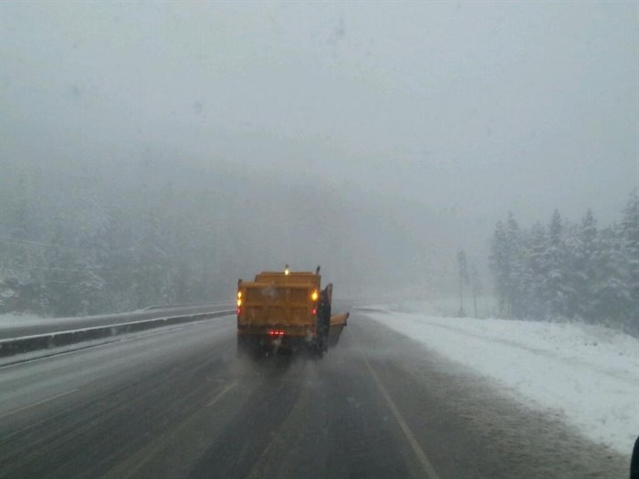
Snowfall warning issued for Coquihalla Highway
Heads up, drivers, a snowfall advisory has been issued for the Coquihalla Highway starting today.
Environment Canada is expecting up to 15 cm of new snow on the mountain pass between Hope and Merritt by midday Tuesday. The weather office says to expect heavy accumulating snow, poor visibility and slippery surfaces.
"A frontal system will move across southern B.C. today and tonight bringing rain and snow to the area. Precipitation will initially start as rain this afternoon as the snow level rises above the Coquihalla Summit," the warning says.
"Rain will change to snow near the summit this evening as the snow level falls to near the summit. Snow will become scattered flurries Tuesday morning and abate near noon. A total of 15 cm is forecast by noon on Tuesday."
The forecast is also calling for a 40% to 60% chance of rain throughout the Thompson-Okanagan today and tomorrow. Expect a high of 12 to 13 Celsius in the Okanagan today and 14 C in Kamloops. Tuesday also brings some likelihood of rain before sun and clouds and warmer temperatures reaching as high was 18 C in the Okanagan and 20 C in Kamloops for the rest of the week.
To contact a reporter for this story, email Marshall Jones or call 250-718-2724 or email the editor. You can also submit photos, videos or news tips to the newsroom and be entered to win a monthly prize draw.
We welcome your comments and opinions on our stories but play nice. We won't censor or delete comments unless they contain off-topic statements or links, unnecessary vulgarity, false facts, spam or obviously fake profiles. If you have any concerns about what you see in comments, email the editor in the link above. SUBSCRIBE to our awesome newsletter here.