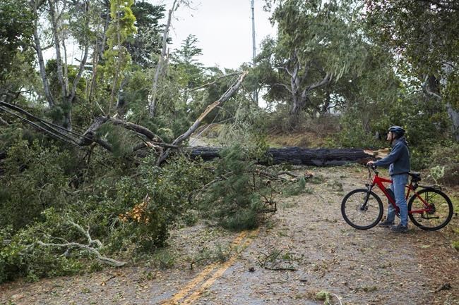
A cyclist looks at a large tree that took out power lines as it fell across Sylan Road in Monterey, Calif., Saturday, Dec. 14, 2024. (AP Photo/Nic Coury)
Republished December 14, 2024 - 2:45 PM
Original Publication Date December 14, 2024 - 9:51 AM
OMAHA, Neb. (AP) — A major ice storm created treacherous driving conditions across Iowa and eastern Nebraska this weekend and prompted temporary closures of Interstate 80 after numerous cars and trucks slid off the road.
Many events were canceled across the region when the storm hit Friday evening, and businesses announced plans to open late Saturday as officials urged people to stay home if possible. Temperatures rose high enough in the afternoon to melt the ice in most places, however.
“Luckily some warmer air is moving in behind this to make it temporary,” said Dave Cousins, a meteorologist with the National Weather Service's office in Davenport, Iowa.
At least one person died in a crash caused by the icy roads in eastern Nebraska. The Washington County Sheriff's office said a 57-year-old woman died after she lost control of her pickup on Highway 30 near Arlington and hit an oncoming truck. The other driver sustained minor injuries.
Elsewhere a storm and wind gusts of up to 60 mph (96 kph) prompted the first tornado warning in San Francisco and caused some damage. Parts of neighboring San Mateo County were also included in the warning, which went out at 5:51 a.m. to about 1 million people in the area. It was lifted by 6:15 a.m.
The storm toppled some trees onto cars and streets and damaged some roofs in San Francisco, which has not seen a tornado since 2005, according to the Weather Service. The damage was being assessed to determine if there was indeed a tornado.
“This was the first ever warning for a possible tornado in San Francisco. I would guess there wasn’t a clear signature on radar for a warning in 2005,” said Roger Gass, a meteorologist in the Weather Service's Monterey, California. He said he was not there in 2005.
The fast-moving storm prompted warnings for residents to take shelter, but few people have basements in the area.
“The biggest thing that we tell people in the city is to put as many walls between you and the outside as possible,” Meteorologist Dalton Behringer said.
In upstate New York, people were digging out after heavy snow fell. More than 33 inches (84 centimeters) was reported near Orchard Park, where residents are used to dealing with lake-effect snow this time of year.
And in Nevada, up to 3 feet (91 centimeters) of snow was forecast for Sierra Nevada mountaintops, with a winter storm warning in effect through 10 p.m. More than a foot fell at some Lake Tahoe ski resorts, according to the National Weather Service's Reno office.
Interstate 80 was closed for about an 80-mile (130-kilometer) stretch from Applegate, California, to the Nevada state line just west of Reno, where rain was falling and a winter weather advisory remained in effect through the afternoon.
In western Washington, tens of thousands of people lost electricity Saturday, local news outlets reported, amid a system that brought rain and gusty winds.
___
Associated Press reporters Julie Walker in New York, Becky Bohrer in Juneau, Alaska, and Scott Sonner in Reno, Nevada, contributed.
News from © The Associated Press, 2024