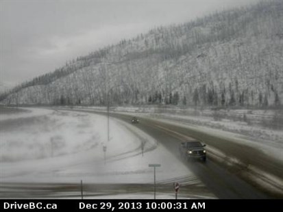
An image from the Drive B.C. camera on Highway 5 at Agate Bay Road, south of Barriere, looking south.
Image Credit: Drive BC
December 29, 2013 - 10:32 AM
SNOW MAKES STREETS AND HIGHWAYS SLICK
KAMLOOPS – Around 2 cm of snow fell Sunday morning in Kamloops and area Sunday. With the temperature hovering around 0 C, the fresh snow turned the roads into a slushy, slippery mess.
Environment Canada is calling for flurries for the rest of the day with a high of 1 C and a low of -1 C Sunday night. Tomorrow expect flurries and a high of 1 C.
A snowfall warning had been issued for the region north of Kamloops and Salmon Arm. The forecasters were calling for an additional 10 to 15 cm snow Sunday to add to the 5 cm already on the ground. As of 10:30 a.m., the warning was ended.
A low pressure system moving through Central B.C. brought heavy snow to the North Columbia, North Thompson and Yellowhead regions.
The snow has tappered to flurries as the system moves into Alberta.
To contact the reporter for this story, email halexander@infotelnews.ca or call 250-491-0331.
- This story was updated at 10:31 a.m., Dec. 29, 2013 when Environment Canada ended the snowfall warning for the North Thompson region.
News from © iNFOnews, 2013