
UPDATE: 'It's going to be bad': Terrible weekend for travel between Lower Mainland to Southern Interior
The good news is the terribly cold temperatures currently hitting much of B.C. are going to ease, starting tomorrow.
That bad news is that the warming air arriving tomorrow, Dec. 23, is going to create havoc on the roads.
“It’s going to be a difficult, difficult travel weekend,” Environment Canada meteorologist Brian Proctor told iNFOnews.ca. “It’s going to bad.”
Travel advisories have now been issued for the Lower Mainland, Southern Interior and Southern Vancouver Island. Drivers are advised to not travel from late Thursday evening into Saturday. If travel is essential, people need to make sure their vehicles are prepared and they have emergency kits on hand.
The Ministry of Transportation is warning that highways may be closed on short notice due to safety concerns.
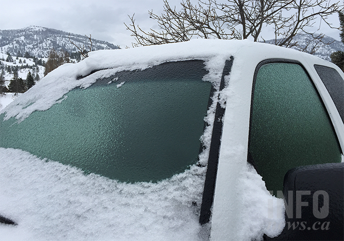
Snow will start falling around midnight tonight in the Lower Mainland and Southern Interior but as a system of warm Pacific air moves in it's likely to produce copious amounts of freezing rain, especially in the eastern parts of the Fraser Valley.
Abbotsford, for example, is forecast to have a high of -5 Celsius tomorrow but will warm to 5 C on Saturday.
READ MORE: Extreme cold warnings blanket Western Canada as winter officially arrives
“We’ve got this really cold Arctic air sitting over the Interior of the province and flooding out through the Fraser Canyon so it’s likely we’ll see some freezing precipitation,” Proctor said. “It’s going to be a question of how fast it changes over to rainfall but, I think, there will be portions of the Fraser Valley that will see significant freezing rain.”
Such periods of freezing rain have lasted from 12 to 24 hours in the past.
Matt MacDonald, lead forecaster for the B.C. Wildfire Service, posted on Twitter that it’s likely to last longer.
“The rain falling into the icebox that is the Fraser Valley will freeze on immediate contact with the grounds/roads/bridge decks/power lines/structures and create an instantaneous coating of sheer ice for 36-plus hours,” he posted.
Proctor only went so far as to say the duration is unpredictable and depends on how fast the low-lying Arctic air is pushed out of the Fraser Valley.
He does agree that there’s going to areas of sheer ice.
“It’s really going to be a matter of what the highways crews do down there, what kind of materials they get down on that road base before the precipitation starts to fall,” Proctor said.
“By late on Saturday, we’re probably getting significant amounts of rain on top of that existing snow pack and the freezing rain that fell before the warm air floods in," he said. "It’s going to be a mess. It’s going to be a real mess and, the further out the Valley you go, the worse it gets.”
On top of treacherous driving conditions, the freezing rain is likely to build up on trees, causing branches to break and knock out power lines, People in the Lower Mainland are warned to be prepared to be without electricity for up to a week.
But it doesn’t stop there.
READ MORE: iN TRAFFIC: Brace for another extremely cold day in the Interior
The Coquihalla and Hope Princeton highways may not get as much freezing rain but likely will get some along with snow and ice pellets, which is freezing rain that turns to ice before hitting the ground.
“It’s going to be a mess through that area as well,” Proctor said. “We’re really looking at a difficult series of days from a transportation point of view which, unfortunately, is lining up with the Christmas holiday season.”
Those sitting snuggly and smugly in their homes in Kamloops and the Okanagan shouldn't get too comfortable either since they'll be forced outside to shovel the massive amounts of snow that will fall.
The good news is that freezing rain is not likely as the region is expected to stay below freezing through until Monday. It will barely rise above the freezing mark into next week.
Five to 10 centimetres of snow are expected to fall in the valley bottoms on Friday with up to 20 cm in the mountains.
“Over the weekend, we’ll probably see 20 to 30 cm for many of the communities down in the valley bottoms,” Proctor said.
For the latest on road conditions in the province visit DriveBC here.
For the latest on weather warnings, check out Environment Canada's public alert web page here.
— This article was updated at 3:30 p.m. Thursday, Dec. 22, 2022 to add new travel advisories.
To contact a reporter for this story, email Rob Munro or call 250-808-0143 or email the editor. You can also submit photos, videos or news tips to the newsroom and be entered to win a monthly prize draw.
We welcome your comments and opinions on our stories but play nice. We won't censor or delete comments unless they contain off-topic statements or links, unnecessary vulgarity, false facts, spam or obviously fake profiles. If you have any concerns about what you see in comments, email the editor in the link above.