
iN TRAFFIC: Expect terrible driving conditions on Thompson-Okanagan roadways
Snowfall warnings continue today, Dec. 20, for the Coquihalla Highway, Highway 3 from Hope to Princeton and the South Okanagan with snowfall accumulation of up to 20 cm in some areas.
“A low pressure system will move through Washington State today,” the Environment Canada warning says. “The associated front will brush the very southern part of British Columbia, giving a round of snow this morning through late this afternoon.”
Weather warnings, either for snow, storms or cold, cover most of the province.
The worst parts of the Coquihalla Highway, according to DriveBC start 6 km south of the Great Bear Snowshed and continue through Kamloops.
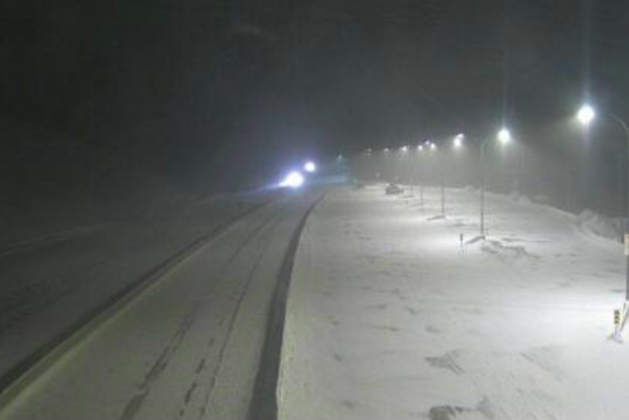
A vehicle incident led to the closure of the Coquihalla Highway about 5 km north of Hope this morning.
DriveBC posted notice of the closure at 10:28 a.m. but did not provide details about the nature of the event. A photo of the incident posted to Facebook shows a number of transport trucks stopped on the road and other vehicles, apparently, stuck in deep snow. It warns that there will be major delays on the highway.
READ MORE: Vehicle incident closes Coquihalla Highway near Hope
This comes as snow continues to fall in the Lower Mainland through to the Okanagan with 10 to 15 cm of snow expected through the mountains today.
The next update about the highway closure is scheduled for 11:30 a.m.
Even so, current weather conditions in the Lower Mainland show snow and blowing snow so expect snow throughout the region.
“Be prepared to adjust your driving with changing road conditions,” the weather warning says. “Surfaces such as highways, roads, walkways and parking lots may become difficult to navigate due to accumulating snow. If visibility is reduced while driving, turn on your lights and maintain a safe following distance”
The Environment Canada Travellers Forecast page calls for 10-15 cm on the Coquihalla Highway from Hope to Merritt with high temperatures of -22 Celsius. The snow should ease to a 60% chance of flurries this evening but with gusty winds and a low of -30 C.
Only 5 cm of snow are expected from Merritt to Kamloops with gusty winds and highs of -25 C. It should clear this evening but gusty winds are still expected with lows of -30 C.
The Okanagan Connector is expecting 5-10 cm of snow, gusty winds with a high of -21 C. It should clear this evening but winds will continue and the low overnight is forecast to be -34 C.
Highway 3 from Hope to Princeton may get as much as 20 cm of snow with a high of -19 C and gusty winds. It should clear before morning with lows of -28 C.
Highway 1 from Eagle Pass to Rogers Pass is forecast to only get 2-4 cm of snow, beginning this morning with a high of -25 C. The snow should end this evening with an overnight low of -32.
READ MORE: Heavy snow in Vancouver causing flight delays, cancellations in Kelowna, Kamloops
An extreme cold warning was issued this afternoon for the North and South Thompson, including Kamloops, the Shuswap, including Salmon Arm, the North and Central Okanagan, including Vernon and Kelowna, along with Similikameen.
Environment Canada said a very cold Arctic air mass has settled over the regions. Expect temperatures near -25 C to -30 C with northeast winds up to 15 km/h resulting in wind chill values near minus 40. Temperatures will slowly rise Thursday and Friday, raising wind chill values above -35 C.
"Watch for cold related symptoms: shortness of breath, chest pain, muscle pain and weakness, numbness and colour change in fingers and toes," the extreme cold warning states. "If it’s too cold for you to stay outside, it’s too cold for your pet to stay outside.
"Extreme cold warnings are issued when very cold temperatures or wind chill creates an elevated risk to health such as frost bite and hypothermia."
Penticton, being closer to the storm front, could get 5-10 cm of snow through this afternoon. Winds could gust to 50 km/h with a wind chill near -25 C even though the daytime high is forecast to be -12 C.
Similar snow and wind conditions are forecast for Kelowna and Vernon with daytime highs of -15 C and overnight lows of -24 C to -26 C.
Kamloops is forecast to get only 2-4 cm of snow, ending near noon but winds gusting up to 50 km/h could drop the wind chill factor to -36 C. Today’s high temperature is forecast to be -20 C with an overnight low tonight of -29 C.
No new snow has been recorded at Sun Peaks Ski Resort in the last 48 hours, leaving an alpine base of 91 cm. It’s -21 C.
Silver Star Mountain Resort is -18 C with 2 cm of new snow, giving an alpine base of 119 cm.
Big White Ski Resort has 4 cm of new snow in the last 24 hours, has an alpine base of 103 cm and a temperature of -22 C.
Apex Mountain Resort sits at -26 C with 5 cm of new snow in the last 24 hours and an alpine base of 126 cm.
— This story was updated at 11:09 a.m. Tuesday, Dec. 20, 2022, to add information about the Coquihalla Highway closure.
— This story was updated at 2:22 p.m. Tuesday, Dec. 20, 2022, with information about an extreme cold warning.
To contact a reporter for this story, email Rob Munro or call 250-808-0143 or email the editor. You can also submit photos, videos or news tips to the newsroom and be entered to win a monthly prize draw.
We welcome your comments and opinions on our stories but play nice. We won't censor or delete comments unless they contain off-topic statements or links, unnecessary vulgarity, false facts, spam or obviously fake profiles. If you have any concerns about what you see in comments, email the editor in the link above.