
iN PHOTOS: Cyclists enjoy new trail between Peachland and West Kelowna
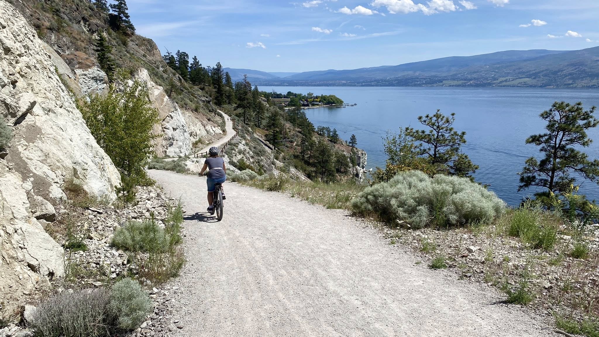
Riders and hikers are exploring a newly constructed multi-use pathway running from Peachland below Highway 97 to a park in West Kelowna.
Peachland resident Kim Kleineberg has hit the trail twice on her e-bike since the Westside Multi-Use Trail opened to the public on May 23.
“It’s doable on a regular bike and it’s super accessible right at the end of Peachland,” she said. “It’s not a long bike ride. It’s quite hilly and incredibly scenic, you can see all across the lake. And there's a circular area along the route to take a quick break at and take in the views, it’s really pretty."
Construction of the trail section by the City of Peachland began in October 2024 under the initiative of the Trail of the Okanagans Society, an advocacy group focussed on connecting fragmented trail sections between the Bennett Bridge in Kelowna and Osoyoos.
The society has been working with four other trail advocacy groups in the Okanagan on a broader goal to create a continuous trail from Sicamous to Osoyoos using existing rail trail sections and filling in the gaps.
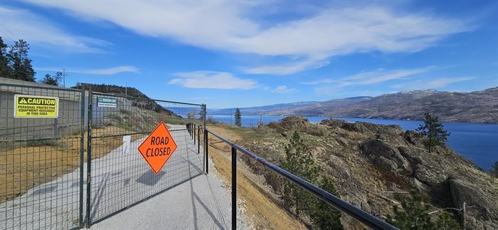
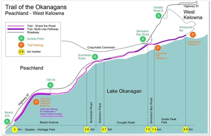
The new five-kilometre double-track pathway runs between Robinson Lane in Peachland and Goats Peak Park in West Kelowna near Seclusion Bay Road, and society president Janice Liebe said it was a particularly tough section to complete.
“It’s the most technically difficult piece of trail to build in the whole alignment that would connect Sicamous down to Osoyoos because of the grades and little pieces of land where we had to build within the highway easement,” she said.
“There was a lot of back and forth with engineering, but we finally managed to get there.”
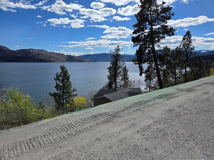
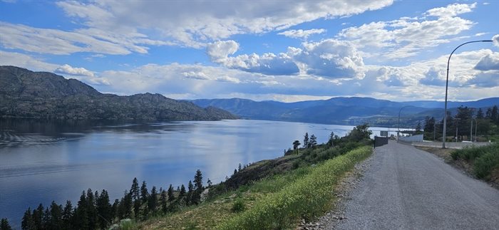
The trail head is considered to be downtown Peachland which is connected to an existing bike lane that connects to the new piece. The new trail runs safely below the highway going up the steep Drought Hill. Once a rider gets to Goats Peak Park, there is a trail that goes down into West Kelowna.
To access the trail from the West Kelowna end, head to Pebble Beach on Whitworth Avenue to a set of stairs with a bike rail.
Take the stairs to the Great Sage Trail in Goats Peak Park and ride south to the Seclusion Bay parking lot. Head up Seclusion Bay Road for a few hundred feet and find the new trail right before the tunnel under the highway.
“At the end of Goat’s Peak Park there is a stair with a bike rail on it but there is a plan to bypass that stair next year and go up to a heritage farm in Gellatly where there are washrooms and parking and a better place for people to connect into it,” Liebe said.
When asked why she's so passionate about her work establishing a connected multi-use trail in the BC Interior, Liebe said “it’s a good idea.”
“Why shouldn’t we have to ability to ride from one end of this valley to another, a pan-Okanagan trail has so many benefits to it. It has numerous social and health benefits, it helps every community with climate goals, it’s a huge economic development project, it increases tourism and connects communities.”
Kleineberg suggests Peachland residents find a place to park anywhere downtown and enjoy the scenic ride along the waterfront before hitting the trail.
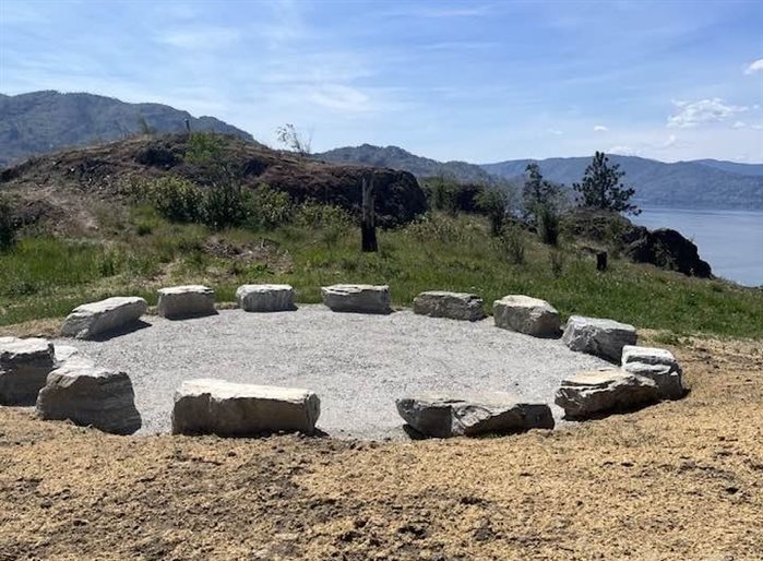
On Friday, June 20, the Trail of the Okanagans Society is hosting a group ride to celebrate the Grand Opening of the trail, beginning at the Gazebo in Heritage Park in Peachland at 9:30 a.m. A ribbon cutting ceremony will be held at a circular crushed gravel area along the the route called the Talking Circle at 10 a.m.
Those who would rather walk can park at the Goats Peak Parking lot on Seclusion Bay Road and walk a shorter distance to the circle.
Go here for more information on the Trail of the Okanagans Society.
To contact a reporter for this story, email Shannon Ainslie or call 250-819-6089 or email the editor. You can also submit photos, videos or news tips to the newsroom and be entered to win a monthly prize draw.
We welcome your comments and opinions on our stories but play nice. We won't censor or delete comments unless they contain off-topic statements or links, unnecessary vulgarity, false facts, spam or obviously fake profiles. If you have any concerns about what you see in comments, email the editor in the link above. SUBSCRIBE to our awesome newsletter here.