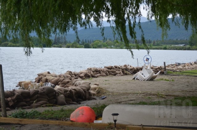
Water continues to rise in Okanagan Lake. The northern tip of the lake near Vernon is pictured in the Wednesday, May 24, 2017 photo.
(CHARLOTTE HELSTON / iNFOnews.ca)
May 25, 2017 - 2:04 PM
VERNON - City of Vernon crews continue to monitor water levels on local creeks and lakes.
Currently, BX Creek levels are lower than they were last week, but may rise quickly with warm weather and snow melt. Residents along BX Creek are reminded to keep sandbags in place until the risk of flooding has passed.
Vernon Creek levels are elevated as water is being released out of Kalamalka Lake. Residents along Vernon Creek should be taking precautions to protect their property.
Okanagan Lake is still steadily rising and approaching record levels. Homeowners along the lake are reminded to remain vigilant about changing conditions and keep flood protection in place until further notice.
The City of Vernon has added a fifth location for residents to obtain sand and sandbags. These locations are:
-
Outside Operations main entrance off of Pleasant Valley Road
-
4005 Pleasant Valley Road
-
Corner of Okanagan Ave and Okanagan Landing Road (across from Marshall Fields)
-
Okanagan Hills Blvd and Bella Vista Road. intersection (entrance to the Rise community)
-
8974 Okanagan Landing Road
Boating is strongly discouraged on local lakes as levels are rising and swells in wind create more severe conditions. Any boats still on lifts at docks should be removed. Launches on Tronson Road and Okanagan Landing Road remain open for this purpose.
More information on emergency preparation can be found here: www.vernon.ca/homes- building/fire-safety/emergency-management.
News from © iNFOnews, 2017